Coasts & Seas
Submerged breakwater Ouidah, Benin
Client: Jan De Nul Group
In front of the Coast of Benin, a submerged breakwater has been constructed with an alongshore length of 5 km. The breakwater creates a low-energy zone enhancing the possibilities for swimming, which contributes to the touristic development of the area. The aim of the study is to determine the impact of the breakwater on waves, alongshore currents and bed level change. To this end, several models have been used. Firstly, a Delft3D model was calibrated with surveys and applied to simulate bed level change for a 10-year period. Secondly, SWASH and XBeach (non-hydro) models were applied to analyse wave propagation across the submerged breakwater in great detail.

Burial depth study Borssele
Client: Tennet TSO
In front of the coast of the province of Zeeland, the Borssele wind farm is under construction. The subsea power cables connecting the wind farm zones to the electricity grid on land have to be buried into the seabed to protect them against external threats. However, due to migrating sandbars, sandwaves and bar-channel systems, the seabed along the cable route is mobile, leading to a change in burial depth through time. The main objective of this morphological study is to quantify the optimal burial depth, such that the total costs (installation costs + required maintenance) during the entire lifespan of the power cables are as low as possible. The study shows that the Spijkerplaat, a very morphological active sand bank, has a large effect on the maintenance requirements and optimal installation depth.

Coastline study Lagos, Nigeria
Client: Dredging International
At the port of Lagos (Nigeria), a breakwater is build into the sea. This requires a large amount of sediment, which is dredged in close proximity and then deposited at the location of the breakwater. However, severe coastal erosion occurs in the vicinity of the dredging activities. During this study, the offshore wave climate has been translated to the coast and the alongshore and cross-shore sand transports were determined. The objective of this study is to investigate whether the coastal erosion is related to the dredging activities.

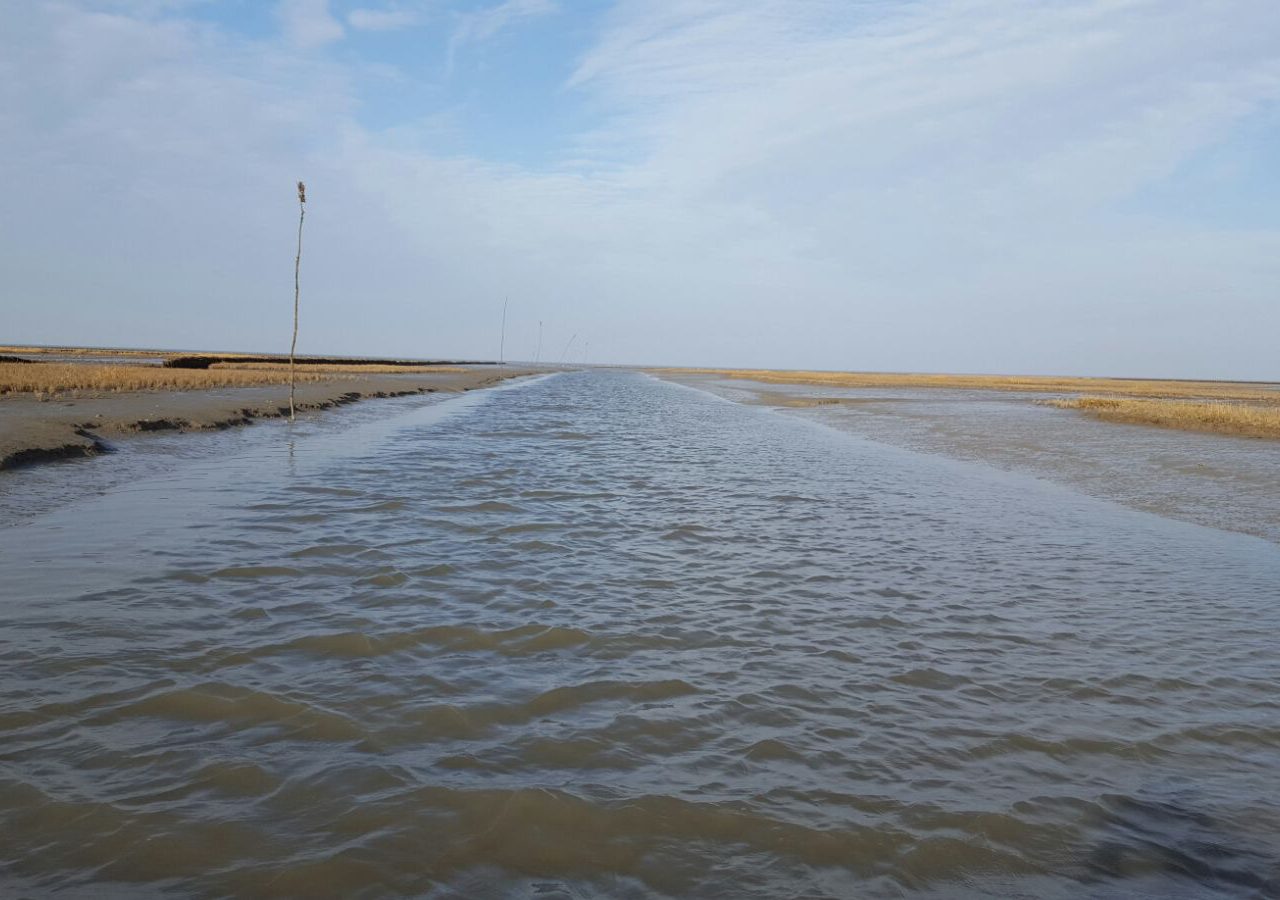
Reducing silt sedimentation Noordpolderzijl
Client: Municipality of Eemsmond
The port of Noordpolderzijl is located in the municipality of Eemsmond, situated at the Wadden Sea coast. In recent years, the port is silting up rapidly and becomes increasingly difficult to access by boat. This study investigates whether low-cost options are available to reduce the silting up of the harbour and navigation channel of Noordpolderzijl. An important part of the study will be devoted to investigating whether the creation of an artificial basin can contribute to this. The first phase of the project mainly focuses on hydrodynamics. By means of data collection, limited field measurements and a first exploration with numerical models it is being investigated whether construction of an artificial basin can influence the water motion in such a way that sediment can be transported out of the channel towards the Wadden Sea.
Ports & Infrastructure
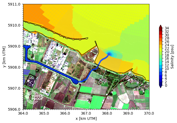
Quickscan hydrodynamic and ecological functioning after relocation of flushing sluice, Delfzijl
In the harbor of Delfzijl (located at the Ems-Dollard estuary, The Netherlands), presently, a sluice is in use for flushing of the Ems canal, in order to prevent exceedance of critical salinity levels resulting from lock exchange due to levelling of ships in the nearby shipping locks at Farmsum. Current plans aim at the installation of a new sluice for flushing at a location towards the east of the harbor, as part of a bigger plan to promote fish migration in the region, to enhance ecological values and to allow for more tidal influences in the area.
WaterProof has studied the effects of the proposed relocation of the sluice on the hydrodynamics and salinity levels of the area for several scenarios. By using a detailed Delft3D hydrodynamic model, in this Quickscan, a comparison is made between the present-day salt intrusion and the expected future salt intrusion from the estuary towards the harbour basins of Delfzijl and the Ems Canal system.
Through direct coupling of the estuarine water system with the inland water system, the effects of tides, the Ems river discharge, the exchange of water by the shipping locks as well as the flushing of fresh water at the sluices could be computed in an integral manner. Consequently, the need for assumptions regarding the salinity levels at several locations within the system vanished, because these levels were resolved by the integrated model itself. Accordingly, the effects of the relocation of the sluice on the water management and ecology could be better substantiated.
The results of this study are used for the detailed design and planning of the polder areas at Delfzijl.
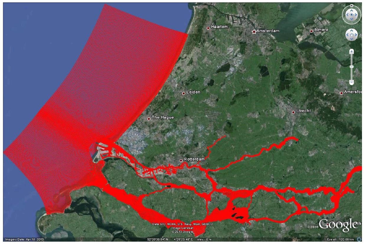
Morphological study deepening New Waterway Rotterdam
Client: Port of Rotterdam / Arcadis
The coming years, the Port of Rotterdam will invest a significant amount of money in revitalization of existing port areas. One of these areas is the Botlek / Vondelingenplaat, where the Port Authority will improve nautical accessibility by deepening. The dredging volumes that are a result of this are significantly larger than the threshold for EIA requirement. For the purpose of preparing the EIA, a morphological study was conducted. This study investigates the effects of the proposed deepening on the channel morphology.
Optimization dredging strategy deepening New Waterway Rotterdam
Client: Port of Rotterdam
The coming years, the Port of Rotterdam will invest a significant amount of money in deepening of the Nieuwe Waterweg and the Botlek / Petroleum harbours. During the execution of thedredging activities, additional turbidity will be generated and hence an increase in sedimentation will occur. By cleverly combining dredging and spreading, the required dredging volumes can be minimized and thus the environmental effects and related costs can be limited. This study provides advice on the most clever dredging strategy, to ensure that the final volumes to be dredged are as small as possible.
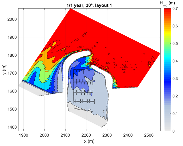
Wave penetration marina Cadzand
Client: Infra Trading/Walcon Marine
The Cadzand marina is planned in the outlet channel west of the town of Cadzand, Zeeuws Vlaanderen, the Netherlands. To facilitate mooring of small yachts and vessels, a set of floating pontoons inside the marina is foreseen. These pontoons are only feasible to position if they can withstand the operational and extreme wave conditions inside the marina. This study (in cooperation with Van Vledder Consulting) investigates whether the wave conditions within the marina are sufficiently low that during operational and extreme situations only limited damage occurs to the pontoons and moored vessels.
Reinforcement Prins Hendrikdijk
Client: Jan De Nul Group
The Prins Hendrikdijk is a dike located at the south-eastern coast of the island of Texel. In 2006, it turned out that this dike did not meet the safety standards as set in the Water Act. Therefore, reinforcement of the Prins Hendrikdijk is necessary. It has been decided to apply an outer dike reinforcement, which combines high water security with nature development. The plan foresees the outer dike construction of a safety dune, a spit with sand rich of shells and a few dynamic lagoons. In this study, WaterProof made a major contribution to the necessary ‘Plan Sand extraction and processing’. This included a detailed analysis of the sand extraction area on the basis of available data (cores, bottom depth, object locations) and determining the available and required sand volumes for this reinforcement.

Marine Ecology
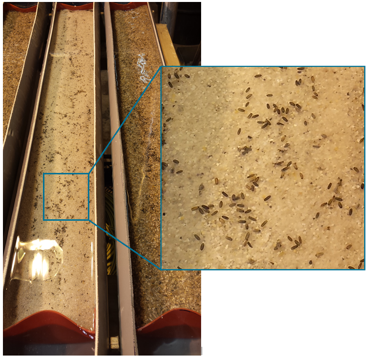
Feasibility study Eelgrass Seed nursery
Funder: Netherlands Enterprise Agency
WaterProof BV. has been awarded with an MIT-subsidy for carrying out a feasibility study for the founding of the Eelgrass Seed nursery®. The cultivation of eelgrass seed will eventually lead to an enrichment of our coastal ecosystems, where the earlier seagrass areas unfortunately have disappeared due to various factors. The product can be exported and used worldwide for eelgrass field construction and restoration projects. Pilot experiments were carried out in collaboration with Tjisse van de Heide and the Fieldwork Company, with the aim of investigating the technical aspects. In addition, the economic aspects, social support and applicable laws and regulations have been studied. The concept was represented to potential stakeholders who’s first responds was positive. The feasibility report can be downloaded here.
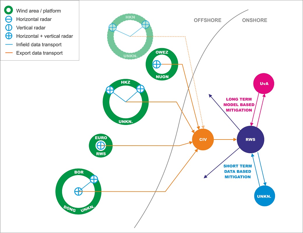
Technical support radar systems offshore wind farms
Client: Rijkswaterstaat Sea and Delta
In periods where many birds migrate over sea, the amount of birds that collides with rotor blades of offshore wind turbines increases. To limit the effects, a mitigation measure is imposed in which the turbines rotate very slowly during bird migration periods. This measure requires insight into the intensity of bird migration (flux). This can be achieved by the use of radar systems and models. In this study, the various systems are identified and the feasibility of setting up these systems on offshore wind turbines is investigated. In addition, bird radar specialists and model developers were asked how to collect the appropriate information for implementing the measure and for model validation. The final report (in Dutch) can be downloaded here.

Potential effects of elektromagnetic fields in the Dutch North Sea
Client: Rijkswaterstaat Water, Traffic and Environment
A strong development of offshore wind farms in the Dutch coastal zone is foreseen in the coming years. These offshore wind farms will be connected to land by subsea power cables that transport the generated energy to shore. These cables generate electromagnetic fields (EMFs) and induced electric fields (iEFs) in the marine environment, the impact of which on the marine ecosystem is largely unknown. To close this gap, WaterProof has started a research project to investigate the effects of electromagnetic fields on the marine environment. This project consists of two distinct parts. The first part comprises a desk study about electromagnetic fields in general and the known effects of electromagnetic fields on marine life and the second part explores the opportunities for designing an experimental setup to study the effects in water basins or in the North Sea.
Specifications radar systems offshore wind farms
Client: Rijkswaterstaat Sea and Delta
In periods where many birds migrate over sea, the number that collides with the rotor blades of offshore wind turbines increases. To reduce the number of collisions, a measure is inflicted in which the turbines will be temporarily shut down during migration periods. In the spring of 2016, WaterProof conducted a technical assessment of suitable radar systems in which the specifications were discussed with various stakeholders. Based on this information, a first move was made towards the installation of radar systems at different wind farms. The objective of this follow-up study is to determine together with stakeholders the functional requirements of the radar systems and describe these in accordance with the CIV contract system, so that based on this a European tender can be set in the market.
Underwater Acoustics
Noise levels during the installation of offshore windfarms in Taiwan
Client: Jan De Nul
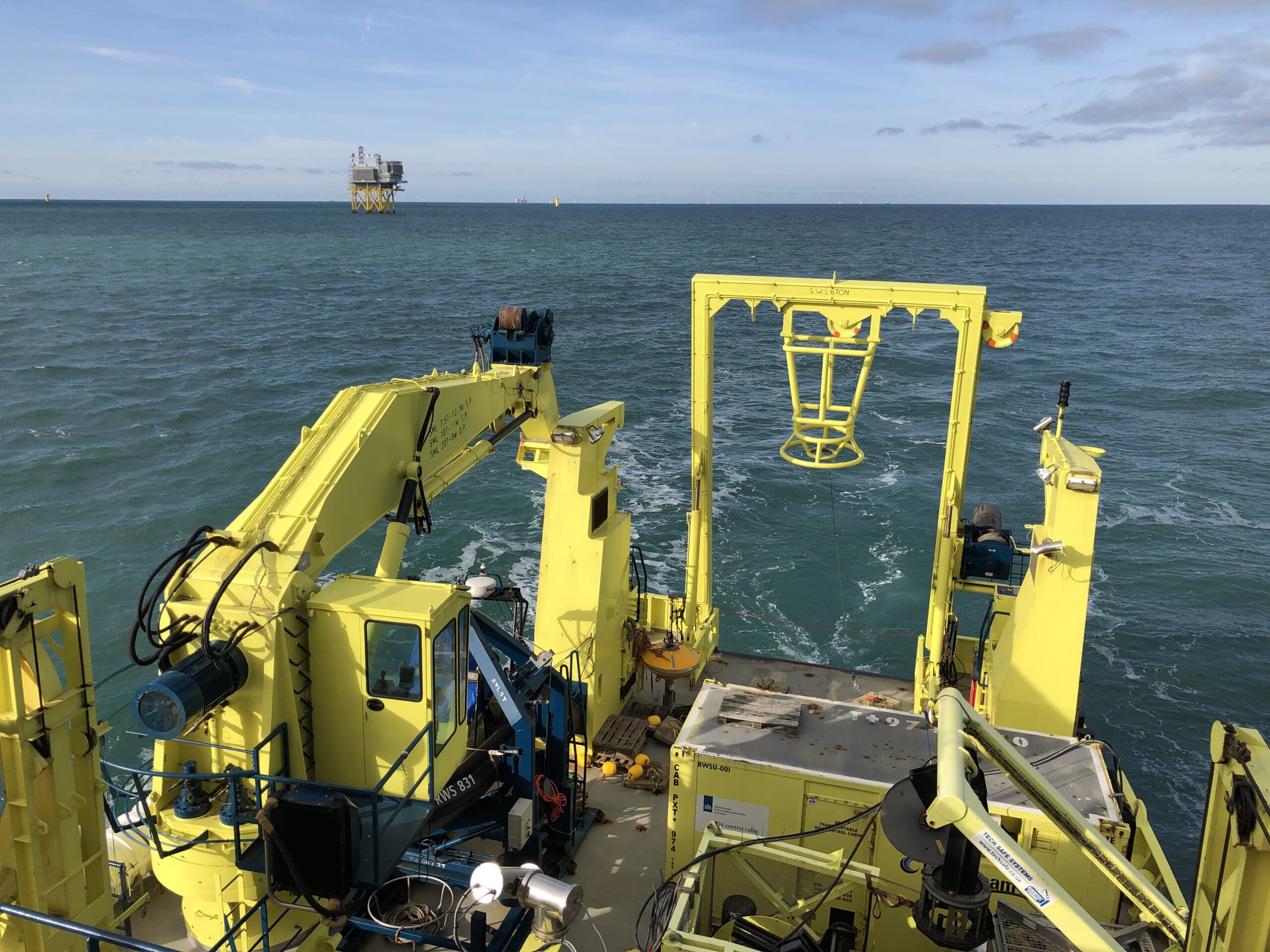
Currently several offshore wind farms are being developed in Taiwan. During the construction of these windfarms, pile driving is the method used to install the foundations for the wind turbines. Pile driving activities induce high underwater noise levels, that can disturb underwater life. To control the underwater noise levels, several mitigation measures are implemented during installation. The Taiwanese government requests that sound measurements are used to show that noise levels were below the threshold during the installation. This is especially important there because of the presence of the critically endangered Taiwanese Humpback Dolphin. WaterProof supports the execution of underwater measurements during the installation phase of several offshore windfarms and conducts the analyses of these sound measurements.

Control measurements of underwater noise at offshore wind farm Borssele
Client: Dutch Ministry of Infrastructure and Water Management
WaterProof conducted noise control measurements during the installation of the foundations for OWF Borssele I+II and OWF Borssele III+IV. Measurements were conducted in three separate weeks during the installation of monopiles by two different contractors. Measured noise levels were compared with permit thresholds and reported per monopile to the Ministry within 24 hours after the completion of piling operations. Our reports were used by the Ministry for law enforcement and to determine the accuracy of the noise measurements conducted by the contractors. Besides conducting the measurements, WaterProof has also been supporting the Ministry as underwater noise experts during this project.
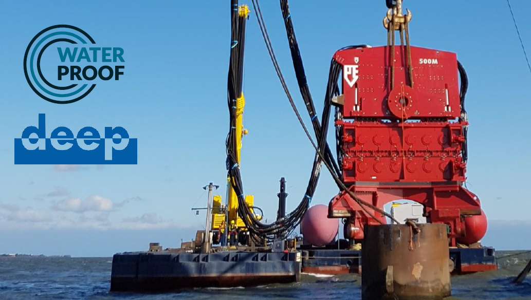
Measurements during removal of old windmills, Medemblik
Client: Deep B.V.
In front of the Coast of Medemblik (located at the lake IJssel), a total of four old windmills were removed in October 2016 because it was no longer profitable to exploit hem. To remove the windmill foundations, a vibratory technology was used. During the vibration periods, WaterProof B.V. conducted measurements with multiple recorders at different distances from the vibration source. The purpose of these measurements is to map the amount of noise that is caused by such offshore activities and to find ways to reduce the noise level in the future. This way, it is possible to comply with set regulations by various countries. See also this flyer for an impression.